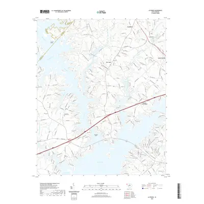
2020 Map of La France
USGS Topo · Published 2020About this map
Hartwell Lake dominates the southern half of this landscape, its fingers reaching deep into the Piedmont where the Seneca River and Coneross Creek once flowed freely. The terrain is defined by the significant hydrological intersection of major tributaries, including Eighteenmile Creek and Three and Twenty Creek, which converge as they enter the reservoir. This modern survey illustrates the current shoreline and the contemporary road network that serves the communities of La France and Sandy Springs along the northeast corridor.
Find a feature on this map
189 named features on this map. Tap any name to fly to it.
Don’t see what you’re looking for? This feature index may not catch every label — zoom into the map to look around manually.
Map Details
Editions of this 2020 La France Map
This is the sole edition of this map. No revisions or reprints were ever made.
Other maps of this area

1888 · Pickens
USGS Topo · 1:125,000

1893 · Elberton
USGS Topo · 1:125,000

1894 · Pickens
USGS Topo · 1:125,000

1950 · La France
USGS Topo · 1:24,000

1951 · La France
USGS Topo · 1:24,000

1951 · Clemson
USGS Topo · 1:24,000

1954 · Greenville
USGS Topo · 1:250,000

1957 · Anderson
USGS Topo · 1:62,500

1958 · Greenville
USGS Topo · 1:250,000

1958 · Seneca
USGS Topo · 1:24,000