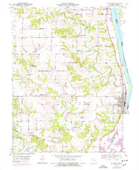
1950 Map of La Grange
USGS Topo · Published 1977About this map
The Mississippi River defines the eastern edge of this Missouri landscape, where the Burlington Northern railroad corridor tracks the water's edge through Canton and La Grange. The interior of Lewis Co is characterized by a dense network of rural one-room schoolhouses, including Pink Prairie Sch, High Hill Sch, and Sunnyside Sch, reflecting the distributed nature of early 20th-century agrarian life. Multiple watercourses such as the Wyaconda River and Sugar Creek carve through the terrain, with small settlements like Dover and Grange Hall serving as local nodes. A complex system of levees protects the lowlands near Dillon Island, while local industry is evidenced by Gravel Pits and a Quarry near the riverbank. This survey captures a moment when rural educational and social structures were still firmly anchored to specific family-named landmarks and local crossroads.
Find a feature on this map
33 named features on this map. Tap any name to fly to it.
Don’t see what you’re looking for? This feature index may not catch every label — zoom into the map to look around manually.
Map Details
Editions of this 1950 La Grange Map
2 editions found

Other maps of this area

1903 · Kahoka
USGS Topo · 1:125,000

1903 · Palmyra
USGS Topo · 1:125,000

1925 · Quincy
USGS Topo · 1:62,500

1944 · Quincy
USGS Topo · 1:62,500

1945 · Quincy
USGS Topo · 1:62,500

1946 · Mendon
USGS Topo · 1:62,500

1948 · Quincy
USGS Topo · 1:250,000

1948 · Mendon
USGS Topo · 1:62,500

1949 · Durham
USGS Topo · 1:24,000

1949 · Maywood
USGS Topo · 1:24,000