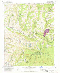
1961 Map of La Honda
USGS Topo · Published 1969About this map
La Honda and the surrounding redwood-dense canyons of the Santa Cruz Mountains appear here during a period of mid-century transition. The 1961 field check, updated with 1968 aerial photography, shows the concentrated development of Redwood Terrace and the expansion of residential footprints near Reflection Lake. While the timber economy of earlier decades is represented by place names like Spanish Ranch and Butano Ridge, the landscape by the 1960s had become a primary retreat for institutional camps and public recreation.
Find a feature on this map
82 named features on this map. Tap any name to fly to it.
Don’t see what you’re looking for? This feature index may not catch every label — zoom into the map to look around manually.
Map Details
Editions of this 1961 La Honda Map
4 editions found
Other maps of this area

1897 · Palo Alto
USGS Topo · 1:62,500

1899 · Palo Alto
USGS Topo · 1:62,500

1902 · Santa Cruz
USGS Topo · 1:125,000

1940 · Halfmoon Bay
USGS Topo · 1:62,500

1940 · Ano Nuevo
USGS Topo · 1:62,500

1941 · Ano Nuevo Pt.
USGS Topo · 1:62,500

1941 · Palo Alto
USGS Topo · 1:62,500

1942 · Ano Nuevo
USGS Topo · 1:62,500

1943 · Palo Alto
USGS Topo · 1:62,500

1943 · Halfmoon Bay
USGS Topo · 1:62,500