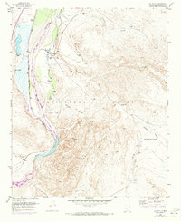
1952 Map of La Joya
USGS Topo · Published 1973About this map
La Joya and its neighboring settlements occupy the fertile valley where the Rio Grande meets the Rio Salado. This mid-century landscape is defined by the critical infrastructure of the Atchison Topeka and Santa Fe railroad and a protective Levee system along the river's western bank. While the town center is marked by the La Joya Cemetery, the surrounding desert plateau reveals a network of land management and resource extraction, including the massive Sevilleta Grant and a cross-country Pipeline. To the east, the terrain breaks into a complex of deep drainage systems like Arroyo Palo Duro and Arroyo Salas, where isolated landmarks like Los Alamos Spring and various Windmill sites provided essential water for ranching operations at Diamond T Ranch. The 1971 revisions, indicated in purple, track the evolving road network and water courses since the original 1952 survey.
Find a feature on this map
30 named features on this map. Tap any name to fly to it.
Don’t see what you’re looking for? This feature index may not catch every label — zoom into the map to look around manually.
Map Details
Editions of this 1952 La Joya Map
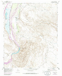
Other maps of this area

1906 · Socorro
USGS Topo · 1:62,500

1916 · La Joya
USGS Topo · 1:125,000

1952 · La Joya NW
USGS Topo · 1:24,000

1952 · San Anacia
USGS Topo · 1:24,000

1952 · Black Butte
USGS Topo · 1:24,000

1952 · La Joya
USGS Topo · 1:24,000

1952 · Becker SW
USGS Topo · 1:24,000

1952 · Abeytas
USGS Topo · 1:24,000

1954 · Socorro
USGS Topo · 1:250,000

1958 · Socorro
USGS Topo · 1:250,000