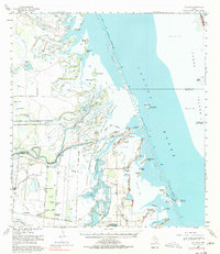
1955 Map of La Leona
USGS Topo · Published 1977About this map
Laguna Atascosa National Wildlife Refuge dominates this mid-century coastal landscape, preserving a complex of tidal flats and islands along the western edge of the Laguna Madre. The map details the transition from the ranching lands of the interior, marked by family outposts like Los Coyotes Ranch and Rancho Nuevo, to the salt-spray environment of Padre Island. A significant portion of the Arroyo Colorado is visible, including the Intracoastal Waterway and its associated Spoil Areas, which indicate the ongoing engineering of Texas coastal transit routes. The presence of Green Island (Bird Sanctuary) and numerous named landforms like Horse Island and Rattlesnake Island reveals an era focused on both wildlife conservation and the navigation of the shallow bays. Local heritage is captured through small settlements and ranch complexes such as La Leona and El Ranchito, providing a clear view of the rural Cameron County layout before modern coastal development.
Find a feature on this map
53 named features on this map. Tap any name to fly to it.
Don’t see what you’re looking for? This feature index may not catch every label — zoom into the map to look around manually.
Map Details
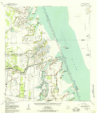
Editions of this 1955 La Leona Map
2 editions found
Other maps of this area

1921 · Tarida Ranch
USGS Topo · 1:62,500

1929 · Rio Hondo
USGS Topo · 1:24,000

1929 · La Coma
USGS Topo · 1:24,000

1929 · Buena Vista
USGS Topo · 1:24,000

1930 · Padre Island No. 1
USGS Topo · 1:24,000

1930 · La Leona
USGS Topo · 1:24,000

1930 · Padre Island No. 2
USGS Topo · 1:24,000

1930 · Laguna Atascosa
USGS Topo · 1:24,000

1932 · Rio Hondo
USGS Topo · 1:31,680

1933 · Paso Real
USGS Topo · 1:31,680
Featured Places
- Coulson Colonia, TX
- Rancho Nuevo, TX
- Arroyo City Subdivision Colonia, TX
- La Leona, TX
- Los Coyotes Ranch, TX