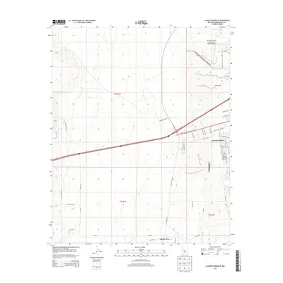
2013 Map of La Mesita Negra SE
USGS Topo · Published 2013About this map
Petroglyph National Monument dominates the northeastern corner of this western Albuquerque landscape, preserving a cultural connection to the high desert terrain. The area is defined by its drainage patterns, including Ladera Arroyo and South Rinconada Arroyo, which cut through the arid flats. Residential expansion is visible along the eastern edge, with a dense network of streets like 98th St NW and Volcano Rd NW beginning to push westward into the open plains. In the southern portion of the sheet, Pajarito Mesa remains largely undeveloped, crossed by utility corridors like Powerline Rd and rural routes such as Pajarito Rd. The map illustrates the sharp boundary between urban development and the protected volcanic escarpment, providing a record of New Mexico’s growth and land management during the early twenty-first century.
Find a feature on this map
42 named features on this map. Tap any name to fly to it.
Don’t see what you’re looking for? This feature index may not catch every label — zoom into the map to look around manually.
Map Details
Editions of this 2013 La Mesita Negra SE Map
This is the sole edition of this map. No revisions or reprints were ever made.
Other maps of this area

1888 · Bernalillo
USGS Topo · 1:125,000

1889 · Albuquerque
USGS Topo · 1:125,000

1893 · Albuquerque
USGS Topo · 1:125,000

1934 · West Albuquerque
USGS Topo · 1:24,000

1934 · Griegos
USGS Topo · 1:24,000

1938 · Albuquerque
USGS Topo · 1:62,500

1952 · Wind Mesa
USGS Topo · 1:24,000

1952 · Isleta
USGS Topo · 1:24,000

1952 · Dalies NW
USGS Topo · 1:24,000

1954 · Volcano Ranch
USGS Topo · 1:24,000