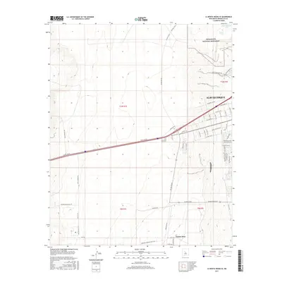
2017 Map of La Mesita Negra SE
USGS Topo · Published 2017About this map
Petroglyph National Monument dominates the northeastern corner of this landscape, where the basalt escarpments of the West Mesa meet the expanding western reaches of Albuquerque. This modern topographic study shows a transition between the volcanic terrain and residential development. Arterial roads like Central Ave NW and Rio Bravo Blvd push westward from the city center, framing the geometric grid of planned streets such as Sunset Gardens Rd SW and Eucariz Ave SW.
Find a feature on this map
46 named features on this map. Tap any name to fly to it.
Don’t see what you’re looking for? This feature index may not catch every label — zoom into the map to look around manually.
Map Details
Editions of this 2017 La Mesita Negra SE Map
This is the sole edition of this map. No revisions or reprints were ever made.
Other maps of this area

1888 · Bernalillo
USGS Topo · 1:125,000

1889 · Albuquerque
USGS Topo · 1:125,000

1893 · Albuquerque
USGS Topo · 1:125,000

1934 · West Albuquerque
USGS Topo · 1:24,000

1934 · Griegos
USGS Topo · 1:24,000

1938 · Albuquerque
USGS Topo · 1:62,500

1952 · Wind Mesa
USGS Topo · 1:24,000

1952 · Isleta
USGS Topo · 1:24,000

1952 · Dalies NW
USGS Topo · 1:24,000

1954 · Volcano Ranch
USGS Topo · 1:24,000