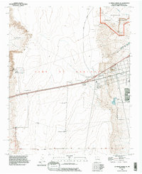
1990 Map of La Mesita Negra SE
USGS Topo · Published 1996About this map
The Town of Atrisco and the southern fringes of the West Mesa are captured here in the early 1990s, showcasing the intersection of suburban expansion and ancient volcanic landscapes. To the northeast, the Petroglyph National Monument protects a significant geological and cultural area, while modern infrastructure like Central Avenue and the I 40 corridor push westward through the high desert. The landscape is characterized by shifting Dunes and Sand in the El Rincon area, alongside modern technical installations including a Radar Facility and several Communication Towers. The map provides a look at late 20th-century development on the Albuquerque periphery, from the established Pajarito boundary to newer residential areas such as Westgate Heights Park and local Mobile Home Park sites. This survey records the region just as the urban footprint began to significantly encounter the volcanic escarpment.
Find a feature on this map
23 named features on this map. Tap any name to fly to it.
Don’t see what you’re looking for? This feature index may not catch every label — zoom into the map to look around manually.
Map Details
Editions of this 1990 La Mesita Negra SE Map
This is the sole edition of this map. No revisions or reprints were ever made.
Other maps of this area

1888 · Bernalillo
USGS Topo · 1:125,000

1889 · Albuquerque
USGS Topo · 1:125,000

1893 · Albuquerque
USGS Topo · 1:125,000

1934 · West Albuquerque
USGS Topo · 1:24,000

1934 · Griegos
USGS Topo · 1:24,000

1938 · Albuquerque
USGS Topo · 1:62,500

1952 · Wind Mesa
USGS Topo · 1:24,000

1952 · Isleta
USGS Topo · 1:24,000

1952 · Dalies NW
USGS Topo · 1:24,000

1954 · Volcano Ranch
USGS Topo · 1:24,000