
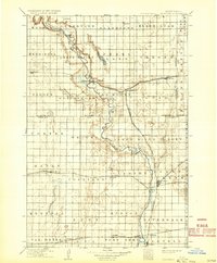
1918 Map of La Moure
USGS Topo · Published 1918About this map
The James River meanders through the heart of the James River Valley on this 1918 edition, reflecting a landscape where the arrival of major rail lines transformed small prairie outposts into essential shipping points. The map details a dense network of competing railroads, including the Northern Pacific and the Great Northern, which connect rural centers such as La Moure, Oakes, and Fullerton. These tracks allowed grain and livestock from the surrounding townships, like Henrietta and Black Loam, to reach broader markets.
Find a feature on this map
58 named features on this map. Tap any name to fly to it.
Don’t see what you’re looking for? This feature index may not catch every label — zoom into the map to look around manually.
Map Details
Editions of this 1918 La Moure Map
2 editions found
Other maps of this area

1894 · Monango
USGS Topo · 1:62,500

1894 · La Moure
USGS Topo · 1:62,500

1894 · Ellendale
USGS Topo · 1:62,500

1894 · Hecla
USGS Topo · 1:62,500

1894 · Savo
USGS Topo · 1:62,500

1894 · Fullerton
USGS Topo · 1:62,500

1894 · Oakes
USGS Topo · 1:62,500

1895 · Lamoure
USGS Topo · 1:125,000

1896 · Columbia
USGS Topo · 1:125,000

1896 · Jamestown
USGS Topo · 1:125,000