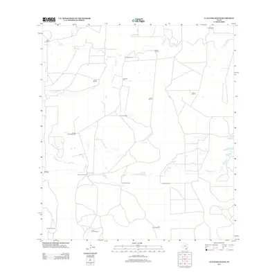
2013 Map of La Paloma Ranch
USGS Topo · Published 2013About this map
La Paloma Ranch sits at the heart of this South Texas landscape, defined by a network of seasonal watercourses and critical ranching infrastructure. The terrain is crisscrossed by drainage systems including Los Olmos Cr, Palo Blanco Cr, and Palobla Cr, which feed intermittent bodies of water like Moreno Lake and McGill Lake. The distribution of named windmills across the range, such as Muchos Hombres Windmill, Monte Negro Windmill, and Encino Mucho Windmill, illustrates the historical and functional layout of a working cattle ranch in this semi-arid region. These features, along with smaller sites like Ebanito Windmill and Carambana Windmill, provide a precise map of water access points that have dictated land use and property boundaries in Kleberg County for generations.
Find a feature on this map
23 named features on this map. Tap any name to fly to it.
Don’t see what you’re looking for? This feature index may not catch every label — zoom into the map to look around manually.
Map Details
Editions of this 2013 La Paloma Ranch Map
This is the sole edition of this map. No revisions or reprints were ever made.
Other maps of this area

1921 · Falfurrias
USGS Topo · 1:125,000

1928 · Sarita
USGS Topo · 1:125,000

1950 · Corpus Christi
USGS Topo · 1:250,000

1954 · Sarita
USGS Topo · 1:62,500

1954 · Riviera
USGS Topo · 1:62,500

1956 · Corpus Christi
USGS Topo · 1:250,000

1956 · Laredo
USGS Topo · 1:250,000

1960 · Corpus Christi
USGS Topo · 1:250,000

1963 · Flowella
USGS Topo · 1:24,000

1963 · Falfurrias SE
USGS Topo · 1:24,000