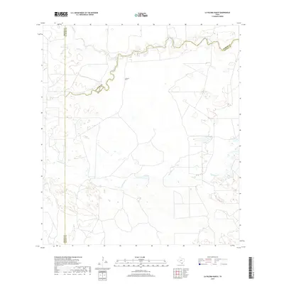
2019 Map of La Paloma Ranch
USGS Topo · Published 2019About this map
La Paloma Ranch anchors this South Texas landscape where the boundaries of Kleberg, Brooks, and Kenedy counties converge. The terrain is defined by a network of intermittent drainage and ephemeral water bodies, most notably the winding course of Los Olmos Creek and its tributary Los Olmos Cr. These waterways, along with Palo Blanco Cr and Palobla Cr, trace the subtle shifts in elevation across the ranching country. The presence of Moreno Lake and McGill Lake indicates essential water sources in this semi-arid environment, while Paisano Cr cuts through the northern reaches. This 2019 survey reflects a modern view of traditional Texas rangeland, where cattle industry infrastructure and property boundaries remain the primary human imprint on the land.
Find a feature on this map
11 named features on this map. Tap any name to fly to it.
Don’t see what you’re looking for? This feature index may not catch every label — zoom into the map to look around manually.
Map Details
Editions of this 2019 La Paloma Ranch Map
This is the sole edition of this map. No revisions or reprints were ever made.
Other maps of this area

1921 · Falfurrias
USGS Topo · 1:125,000

1928 · Sarita
USGS Topo · 1:125,000

1950 · Corpus Christi
USGS Topo · 1:250,000

1954 · Sarita
USGS Topo · 1:62,500

1954 · Riviera
USGS Topo · 1:62,500

1956 · Corpus Christi
USGS Topo · 1:250,000

1956 · Laredo
USGS Topo · 1:250,000

1960 · Corpus Christi
USGS Topo · 1:250,000

1963 · Flowella
USGS Topo · 1:24,000

1963 · Falfurrias SE
USGS Topo · 1:24,000