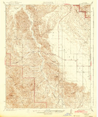
1936 Map of La Panza
USGS Topo · Published 1942About this map
La Panza Range and the western edge of the Carrizo Plain define this interior portion of San Luis Obispo County. Surveyed between 1919 and 1932, the map illustrates a landscape of deep canyons and isolated outposts before modern expansion. Significant ranching and mining history is anchored by La Panza Ranch and the small settlement of La Panza, while numerous water sources like Carnaza Spr and Mustang Spr indicate the vital importance of springs in this semi-arid terrain. The drainage of San Juan Creek cuts a dominant path through the center, flanked by prominent elevations including Mc Chesney Mtn and Syncline Hill. Much of the southern territory is dedicated to the Los Padres National Forest, preserving the complex network of names like Piletas Canyon and Buckhorn Creek that characterize the area's geography.
Find a feature on this map
24 named features on this map. Tap any name to fly to it.
Don’t see what you’re looking for? This feature index may not catch every label — zoom into the map to look around manually.
Map Details
Editions of this 1936 La Panza Map
3 editions found
Other maps of this area

1912 · McKittrick
USGS Topo · 1:125,000

1914 · Lost Hills
USGS Topo · 1:125,000

1914 · Cholame
USGS Topo · 1:125,000

1915 · Cholame
USGS Topo · 1:125,000

1917 · Cholame
USGS Topo · 1:125,000

1922 · Pozo
USGS Topo · 1:62,500

1922 · Nipomo
USGS Topo · 1:62,500

1932 · La Panza
USGS Topo · 1:48,000

1935 · La Panza
USGS Topo · 1:62,500

1936 · La Panza
USGS Topo · 1:62,500