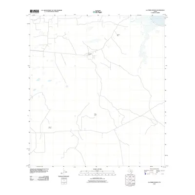
2010 Map of La Parra Ranch
USGS Topo · Published 2010About this map
La Parra Ranch and the surrounding coastal prairie of Kenedy County are captured in this 2010 survey, showcasing the expansive ranching landscape of the Wild Horse Desert. The map reveals the functional infrastructure of a massive South Texas estate, centering on established outposts like Alto de la Cruz and Cabillos Well. To the northeast, the shoreline meets the shallow, hypersaline waters of Baffin Bay, a significant geographic feature of the Laguna Madre system. The presence of the Risken Lookout Tower indicates the ongoing importance of fire and range monitoring in this largely unpopulated, road-dependent territory. This map provides a detailed view of the modern ranching economy, where land management is defined by private roads and isolated water sources rather than conventional township development.
Find a feature on this map
5 named features on this map. Tap any name to fly to it.
Don’t see what you’re looking for? This feature index may not catch every label — zoom into the map to look around manually.
Map Details
Editions of this 2010 La Parra Ranch Map
This is the sole edition of this map. No revisions or reprints were ever made.
Other maps of this area

1928 · Sarita
USGS Topo · 1:125,000

1950 · Corpus Christi
USGS Topo · 1:250,000

1951 · Kleberg Point
USGS Topo · 1:24,000

1951 · Sarita 4 NE
USGS Topo · 1:24,000

1952 · Riviera Beach
USGS Topo · 1:24,000

1952 · La Parra Ranch
USGS Topo · 1:24,000

1952 · Sarita 4 SE
USGS Topo · 1:24,000

1952 · Riviera Beach
USGS Topo · 1:62,500

1954 · La Parra Ranch SW
USGS Topo · 1:24,000

1954 · Sarita
USGS Topo · 1:62,500