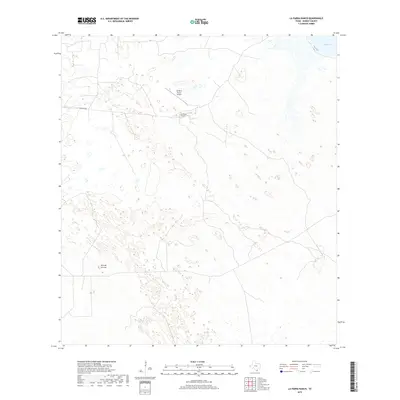
2019 Map of La Parra Ranch
USGS Topo · Published 2019About this map
La Parra Ranch serves as the focal point of this South Texas landscape in Kenedy County, characterized by its expansive ranching heritage and coastal proximity. The map details the infrastructure of this private estate, including the La Parra Ranch Airport and the primary access route, La Parra Ave. The terrain is marked by the coastal reach of Baffin Bay in the northeast corner and the topographic prominence of Alto de la Cruz to the west. This 2019 survey illustrates the specialized land use of the region, where large-scale ranching operations maintain private aviation facilities and a network of interior roads far from the major population centers of the Gulf Coast.
Find a feature on this map
5 named features on this map. Tap any name to fly to it.
Don’t see what you’re looking for? This feature index may not catch every label — zoom into the map to look around manually.
Map Details
Editions of this 2019 La Parra Ranch Map
This is the sole edition of this map. No revisions or reprints were ever made.
Other maps of this area

1928 · Sarita
USGS Topo · 1:125,000

1950 · Corpus Christi
USGS Topo · 1:250,000

1951 · Kleberg Point
USGS Topo · 1:24,000

1951 · Sarita 4 NE
USGS Topo · 1:24,000

1952 · Riviera Beach
USGS Topo · 1:24,000

1952 · La Parra Ranch
USGS Topo · 1:24,000

1952 · Sarita 4 SE
USGS Topo · 1:24,000

1952 · Riviera Beach
USGS Topo · 1:62,500

1954 · La Parra Ranch SW
USGS Topo · 1:24,000

1954 · Sarita
USGS Topo · 1:62,500