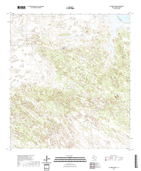
2022 Map of La Parra Ranch
USGS Topo · Published 2022About this map
La Parra Ranch Cem sits at the heart of this coastal ranching landscape in Kenedy County, a remote stretch of South Texas defined by its sandy plains and proximity to the Gulf of Mexico. This modern 2022 survey captures the specialized infrastructure of a working ranch, where long thoroughfares like La Parra Ave cut through the terrain to connect disparate parts of the property. The northeastern corner of the map touches the waters of Baffin Bay, while the low-lying interior topography is punctuated by localized high points such as Alto de la Cruz. The sparse distribution of named features reflects the immense scale of individual land holdings in this part of the state, where life and economy revolve around large-scale livestock operations and the management of coastal brushland.
Find a feature on this map
4 named features on this map. Tap any name to fly to it.
Don’t see what you’re looking for? This feature index may not catch every label — zoom into the map to look around manually.
Map Details
Editions of this 2022 La Parra Ranch Map
This is the sole edition of this map. No revisions or reprints were ever made.
Other maps of this area

1928 · Sarita
USGS Topo · 1:125,000

1950 · Corpus Christi
USGS Topo · 1:250,000

1951 · Kleberg Point
USGS Topo · 1:24,000

1951 · Sarita 4 NE
USGS Topo · 1:24,000

1952 · Riviera Beach
USGS Topo · 1:24,000

1952 · La Parra Ranch
USGS Topo · 1:24,000

1952 · Sarita 4 SE
USGS Topo · 1:24,000

1952 · Riviera Beach
USGS Topo · 1:62,500

1954 · La Parra Ranch SW
USGS Topo · 1:24,000

1954 · Sarita
USGS Topo · 1:62,500