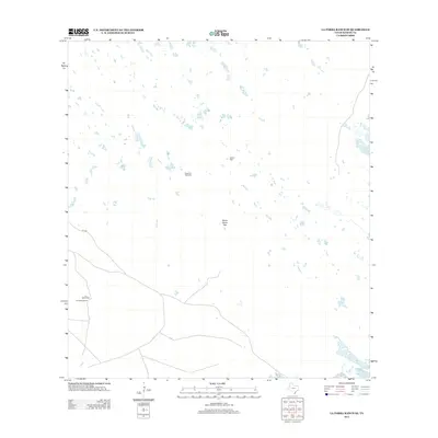
2013 Map of La Parra Ranch SE
USGS Topo · Published 2013About this map
Los Indios Ranch and its surrounding working lands in Kenedy County define this landscape, illustrating the spatial organization of South Texas ranching operations in the early 21st century. The map reveals the infrastructure required for livestock management in a semi-arid environment, characterized by widely distributed water sources such as Agujon Well, Chaparral Windmill, and Los Indios Well. A distinct feature of this layout is the Santa Elena Trap, a specialized enclosure typical of large-scale cattle territories. Connectivity across the brushland is maintained through local routes like CR 1328, which links remote outposts and water stations. This 2013 survey provides a clear view of the persistence of traditional land use and the reliance on subterranean water sources in this part of the Kenedy County ranching corridor.
Find a feature on this map
6 named features on this map. Tap any name to fly to it.
Don’t see what you’re looking for? This feature index may not catch every label — zoom into the map to look around manually.
Map Details
Editions of this 2013 La Parra Ranch SE Map
This is the sole edition of this map. No revisions or reprints were ever made.
Other maps of this area

1923 · Lopena Island
USGS Topo · 1:62,500

1923 · Saltillo Ranch
USGS Topo · 1:62,500

1928 · Sarita
USGS Topo · 1:125,000

1950 · Corpus Christi
USGS Topo · 1:250,000

1951 · Potrero Lopeno NW
USGS Topo · 1:24,000

1951 · Sarita 4 NE
USGS Topo · 1:24,000

1952 · Potrero Cortado
USGS Topo · 1:24,000

1952 · La Parra Ranch
USGS Topo · 1:24,000

1952 · Yarborough Pass
USGS Topo · 1:24,000

1952 · Sarita 4 SE
USGS Topo · 1:24,000