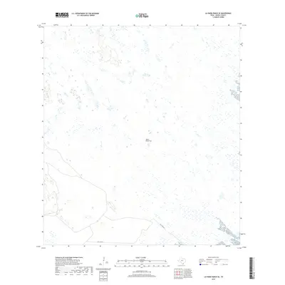
2019 Map of La Parra Ranch SE
USGS Topo · Published 2019About this map
Santa Elena Trap and the southeastern reaches of the Los Indios Ranch dominate this 2019 survey of the Kenedy County landscape. The terrain is characterized by a high concentration of wetlands and depressions typical of the South Texas sand sheet, where water collection points like Santa Elena Trap served as vital infrastructure for the cattle ranching operations that have long defined the region's economy. Movement through this sparse coastal environment is primarily facilitated by Gulf Wind Rd, which cuts across the southern portion of the quadrangle. This map provides a clear view of the modern boundaries and land management patterns in a part of the state where private ranching interests and conservation wetlands converge.
Find a feature on this map
2 named features on this map. Tap any name to fly to it.
Don’t see what you’re looking for? This feature index may not catch every label — zoom into the map to look around manually.
Map Details
Editions of this 2019 La Parra Ranch SE Map
This is the sole edition of this map. No revisions or reprints were ever made.
Other maps of this area

1923 · Lopena Island
USGS Topo · 1:62,500

1923 · Saltillo Ranch
USGS Topo · 1:62,500

1928 · Sarita
USGS Topo · 1:125,000

1950 · Corpus Christi
USGS Topo · 1:250,000

1951 · Potrero Lopeno NW
USGS Topo · 1:24,000

1951 · Sarita 4 NE
USGS Topo · 1:24,000

1952 · Potrero Cortado
USGS Topo · 1:24,000

1952 · La Parra Ranch
USGS Topo · 1:24,000

1952 · Yarborough Pass
USGS Topo · 1:24,000

1952 · Sarita 4 SE
USGS Topo · 1:24,000