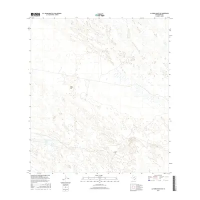
2016 Map of La Parra Ranch SW
USGS Topo · Published 2016About this map
Padre Juanito Trap and Marana Trap anchor this section of the South Texas brush country within the expansive ranching lands of Kenedy County. The landscape is defined by its distinct natural hydrology and specialized agricultural enclosures, notably the prominent Cayo Grande water feature in the southwest quadrant. This map documents the remote coastal prairie and dune systems as they appeared in the early 21st century, showing a network of private roads and trails that serve the traditional cattle-rearing operations of the region. The sparse distribution of named features highlights the isolated character of these large-scale ranch holdings, where specific traps and water sources were critical for land management and stock containment.
Find a feature on this map
3 named features on this map. Tap any name to fly to it.
Don’t see what you’re looking for? This feature index may not catch every label — zoom into the map to look around manually.
Map Details
Editions of this 2016 La Parra Ranch SW Map
This is the sole edition of this map. No revisions or reprints were ever made.
Other maps of this area

1923 · Armstrong
USGS Topo · 1:62,500

1923 · Saltillo Ranch
USGS Topo · 1:62,500

1928 · Sarita
USGS Topo · 1:125,000

1950 · Corpus Christi
USGS Topo · 1:250,000

1951 · Sarita 4 NE
USGS Topo · 1:24,000

1952 · La Parra Ranch
USGS Topo · 1:24,000

1952 · Sarita 4 SE
USGS Topo · 1:24,000

1953 · Brownsville
USGS Topo · 1:250,000

1954 · La Parra Ranch SW
USGS Topo · 1:24,000

1954 · Sarita
USGS Topo · 1:62,500