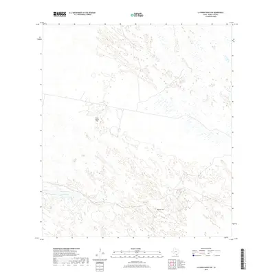
2019 Map of La Parra Ranch SW
USGS Topo · Published 2019About this map
Padre Juanito Trap and Marana Trap characterize the rural landscape of this Kenedy County territory, reflecting the enduring cattle-ranching heritage of South Texas. The terrain is marked by a complex network of wetland depressions and undulating topography typical of the coastal sand plains. Water is a defining feature of the area, most notably the Cayo Grande, which cuts through the southern portion of the sheet. The prevalence of named traps indicates a managed ranching environment where specific enclosures were historically used for gathering and handling livestock across the open range. This 2019 survey documents the sparsely populated but geographically distinct coastal prairie before it transitions toward the Laguna Madre.
Find a feature on this map
3 named features on this map. Tap any name to fly to it.
Don’t see what you’re looking for? This feature index may not catch every label — zoom into the map to look around manually.
Map Details
Editions of this 2019 La Parra Ranch SW Map
This is the sole edition of this map. No revisions or reprints were ever made.
Other maps of this area

1923 · Armstrong
USGS Topo · 1:62,500

1923 · Saltillo Ranch
USGS Topo · 1:62,500

1928 · Sarita
USGS Topo · 1:125,000

1950 · Corpus Christi
USGS Topo · 1:250,000

1951 · Sarita 4 NE
USGS Topo · 1:24,000

1952 · La Parra Ranch
USGS Topo · 1:24,000

1952 · Sarita 4 SE
USGS Topo · 1:24,000

1953 · Brownsville
USGS Topo · 1:250,000

1954 · La Parra Ranch SW
USGS Topo · 1:24,000

1954 · Sarita
USGS Topo · 1:62,500