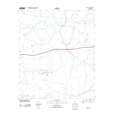
2011 Map of La Place
USGS Topo · Published 2011About this map
Chewacla Creek and Calebee Creek dominate this central Alabama landscape, which preserves a network of rural settlements and family burial grounds north of Tuskegee. The small community of La Place anchors the southern portion of the sheet near Sweet Gum Cemetery, while Franklin and Clough serve as key crossroads to the north. These dispersed hamlets are connected by a web of local routes like Lower Tuskegee Rd and Mahone Barnett Rd, revealing a landscape where agricultural history and genealogy are deeply intertwined.
Find a feature on this map
68 named features on this map. Tap any name to fly to it.
Don’t see what you’re looking for? This feature index may not catch every label — zoom into the map to look around manually.
Map Details
Editions of this 2011 La Place Map
This is the sole edition of this map. No revisions or reprints were ever made.
Other maps of this area

1906 · Dadeville
USGS Topo · 1:125,000

1955 · Phenix City
USGS Topo · 1:250,000

1957 · Phenix City
USGS Topo · 1:250,000

1958 · Phenix City
USGS Topo · 1:250,000

1971 · Carrville
USGS Topo · 1:24,000
1971 · Tallassee
USGS Topo · 1:24,000

1971 · Tuskegee
USGS Topo · 1:24,000

1971 · Shorter
USGS Topo · 1:24,000
1971 · Notasulga
USGS Topo · 1:24,000

1971 · La Place
USGS Topo · 1:24,000