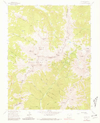
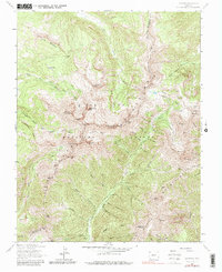
1963 Map of La Plata
USGS Topo · Published 1981About this map
The San Juan Mountains of southwestern Colorado are documented here during a period of 1960s field checking. This terrain within the San Juan National Forest is defined by a dense concentration of high-altitude summits, including the prominent Hesperus Mountain, Centennial Peak, and Sharkstooth Peak. The map provides specific locations for historic resource extraction, featuring the Cumberland Mine near Kennebec Pass and the Gold King Mill along the La Plata River. These industrial landmarks are connected by a network of high-elevation routes such as the High Line Trail and Columbus Pack Trail. Significant drainage patterns are visible through the North Fork West Mancos River and Lewis Creek, illustrating the complex water systems that supported early mining and milling operations across the La Plata Mountains.
Find a feature on this map
76 named features on this map. Tap any name to fly to it.
Don’t see what you’re looking for? This feature index may not catch every label — zoom into the map to look around manually.
Map Details
Editions of this 1963 La Plata Map
5 editions found
Other maps of this area

1895 · La Plata
USGS Topo · 1:62,500

1897 · La Plata
USGS Topo · 1:62,500

1897 · Rico
USGS Topo · 1:62,500

1898 · Durango
USGS Topo · 1:62,500

1898 · Engineer Mountain
USGS Topo · 1:62,500

1898 · Rico
USGS Topo · 1:62,500

1899 · La Plata
USGS Topo · 1:62,500

1899 · Rico
USGS Topo · 1:62,500

1900 · Engineer Mountain
USGS Topo · 1:62,500

1907 · Durango
USGS Topo · 1:62,500