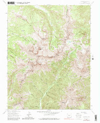
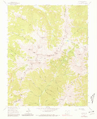
1963 Map of La Plata
USGS Topo · Published 1986About this map
San Juan Mountains peaks dominate this high-altitude landscape along the border of Montezuma and La Plata counties. The 1963 field check identifies a terrain defined by glacial basins and prominent summits, including Hesperus Mountain, Sharkstooth Peak, and Lavender Peak. Evidence of the region's mining heritage is visible at the Gold King Mine and the Cumberland Mine Ruins, while the small settlement of La Plata sits nestled among the headwaters of the La Plata River. A network of high-country paths, such as the Indian Ridge Trail and Sharkstooth Trail, connects the various basins, including Owen Basin and Rush Basin. The map also captures the upper reaches of the Mancos River system and Hermosa Creek, illustrating the complex drainage patterns within the San Juan National Forest before more modern development reached these elevations.
Find a feature on this map
72 named features on this map. Tap any name to fly to it.
Don’t see what you’re looking for? This feature index may not catch every label — zoom into the map to look around manually.
Map Details
Editions of this 1963 La Plata Map
5 editions found
Other maps of this area

1895 · La Plata
USGS Topo · 1:62,500

1897 · La Plata
USGS Topo · 1:62,500

1897 · Rico
USGS Topo · 1:62,500

1898 · Durango
USGS Topo · 1:62,500

1898 · Engineer Mountain
USGS Topo · 1:62,500

1898 · Rico
USGS Topo · 1:62,500

1899 · La Plata
USGS Topo · 1:62,500

1899 · Rico
USGS Topo · 1:62,500

1900 · Engineer Mountain
USGS Topo · 1:62,500

1907 · Durango
USGS Topo · 1:62,500