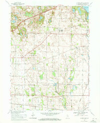
1969 Map of La Porte West
USGS Topo · Published 1971About this map
Pinhook Bog and a dense network of glacial lakes define the landscape west of the city in this 1969 revision. The area shows a transition from the urban edge near Pine Lake and the La Porte Fair Grounds to the fertile agricultural townships of New Durham and Scipio. Settlement patterns are anchored by historic nodes like Door Village and Pinola, while the rural landscape is dotted with local landmarks such as Carmel Chapel and Township Sch. Five major rail lines, including the Penn Central and Norfolk and Western, cut through the countryside, illustrating the region's importance as a transportation corridor between major Midwestern hubs. Geologists and local historians can trace the varied terrain from the southern marshes of Mill Creek to the cluster of northern waters like Stone Lake and Orr Lake.
Find a feature on this map
42 named features on this map. Tap any name to fly to it.
Don’t see what you’re looking for? This feature index may not catch every label — zoom into the map to look around manually.
Map Details
Editions of this 1969 La Porte West Map
3 editions found
Other maps of this area

1953 · Wanatah
USGS Topo · 1:24,000

1953 · Westville
USGS Topo · 1:24,000

1953 · Michigan City West
USGS Topo · 1:24,000

1953 · Chicago
USGS Topo · 1:250,000

1957 · Chicago
USGS Topo · 1:250,000

1958 · Hanna
USGS Topo · 1:24,000

1958 · Kingsford Heights
USGS Topo · 1:24,000

1958 · Michigan City East
USGS Topo · 1:24,000

1958 · La Porte East
USGS Topo · 1:24,000

1958 · Springville
USGS Topo · 1:24,000