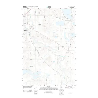
2013 Map of La Prairie
USGS Topo · Published 2013About this map
The Mississippi River and Prairie River converge near the growing hubs of Grand Rapids and La Prairie, marking a landscape defined by its glacial hydrology and modern transportation corridors. During this period, the region serves as a gateway to the Iron Range, with the community of Coleraine situated to the north and the settlement of Blackberry anchored along Us-2 to the southeast. A dense network of local roads such as Trout Lake Rd and River Rd connects numerous inland bodies of water including Mud Lake, Becker Lake, and Hale Lake. Local heritage is preserved at several key sites, including Calvary Cem and the Harris Cem. The presence of the Itasca Community Coll and the Wendigo Golf Course illustrates the transition from a purely industrial and river-based economy toward a regional center for education and recreation.
Find a feature on this map
58 named features on this map. Tap any name to fly to it.
Don’t see what you’re looking for? This feature index may not catch every label — zoom into the map to look around manually.
Map Details
Editions of this 2013 La Prairie Map
This is the sole edition of this map. No revisions or reprints were ever made.
Other maps of this area

1920 · Trout Lake
USGS Topo · 1:62,500

1952 · Calumet
USGS Topo · 1:24,000

1952 · Bovey
USGS Topo · 1:24,000

1953 · Cohasset East
USGS Topo · 1:24,000

1953 · Grand Rapids
USGS Topo · 1:24,000

1954 · Hibbing
USGS Topo · 1:250,000

1957 · Hibbing
USGS Topo · 1:250,000

1958 · Hibbing
USGS Topo · 1:250,000

1964 · Hibbing
USGS Topo · 1:250,000

1969 · La Prairie
USGS Topo · 1:24,000
Featured Places
- Grand Rapids, MN
- Coleraine, MN
- Blackberry, MN
- La Prairie, MN
- Country Acres Mobile Home Park, Grand Rapids