
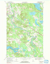
1969 Map of La Prairie
USGS Topo · Published 1972About this map
The Mississippi River and Prairie River converge near La Prairie, creating a complex landscape of oxbows and backwaters in this part of Itasca County. The river’s winding course is mirrored by a series of glacial lakes including Trout Lake, Hale Lake, and Becker Lake, while much of the southern terrain is preserved within the Golden Anniversary State Forest. This environment supported both agriculture and industry, as evidenced by the Univ of Minn Experiment Sta near the northern boundary and numerous Gravel Pits scattered along the Burlington Northern railroad lines. Settlement patterns are concentrated at rail junctions like Gunn and the small community of Blackberry, where local history is anchored by Blackberry Cem and Harris Cem. The transition from river-bottom wetlands to forest and developed rail corridors defines the area's mid-century character.
Find a feature on this map
32 named features on this map. Tap any name to fly to it.
Don’t see what you’re looking for? This feature index may not catch every label — zoom into the map to look around manually.
Map Details
Editions of this 1969 La Prairie Map
2 editions found
Other maps of this area

1920 · Trout Lake
USGS Topo · 1:62,500

1952 · Calumet
USGS Topo · 1:24,000

1952 · Bovey
USGS Topo · 1:24,000

1953 · Cohasset East
USGS Topo · 1:24,000

1953 · Grand Rapids
USGS Topo · 1:24,000

1954 · Hibbing
USGS Topo · 1:250,000

1957 · Hibbing
USGS Topo · 1:250,000

1958 · Hibbing
USGS Topo · 1:250,000

1964 · Hibbing
USGS Topo · 1:250,000
1970 · Warba
USGS Topo · 1:24,000