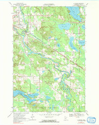
1969 Map of La Prairie
USGS Topo · Published 1991About this map
The Mississippi River meanders through the heart of this landscape, forming complex oxbows and channels south of the junction at Gunn. The region’s economic and social infrastructure is defined by the Burlington Northern railroad lines that serve the settlements of La Prairie and Blackberry. This area in Itasca County reveals a transition between agricultural experimentation at the Univ of Minn Experiment Sta and the timber resources of the Golden Anniversary State Forest. Genealogists will find several burial grounds, including Harris Cem, Blackberry Cem, and Calvary Cemetery, which anchor the local townships. The southern portion of the map is dominated by the Pokegama Reservoir and its Wendigo Arm, while the northeast is characterized by a dense chain of water bodies including Trout Lake, Mud Lake, and Clearwater Lake.
Find a feature on this map
34 named features on this map. Tap any name to fly to it.
Don’t see what you’re looking for? This feature index may not catch every label — zoom into the map to look around manually.
Map Details
Editions of this 1969 La Prairie Map
2 editions found
Other maps of this area

1920 · Trout Lake
USGS Topo · 1:62,500

1952 · Calumet
USGS Topo · 1:24,000

1952 · Bovey
USGS Topo · 1:24,000

1953 · Cohasset East
USGS Topo · 1:24,000

1953 · Grand Rapids
USGS Topo · 1:24,000

1954 · Hibbing
USGS Topo · 1:250,000

1957 · Hibbing
USGS Topo · 1:250,000

1958 · Hibbing
USGS Topo · 1:250,000

1964 · Hibbing
USGS Topo · 1:250,000

1969 · La Prairie
USGS Topo · 1:24,000