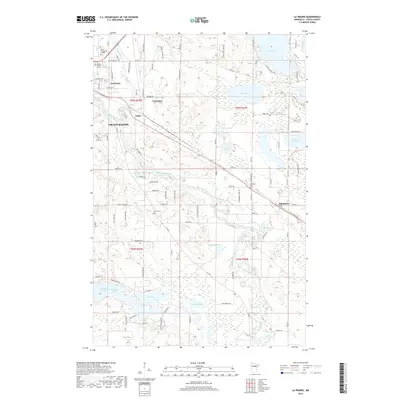
2019 Map of La Prairie
USGS Topo · Published 2019About this map
The Mississippi River winds through this section of Itasca County, serving as the central geographic feature for several small communities and sprawling wetland systems. Grand Rapids and La Prairie sit at the western edge of the sheet, while the smaller settlement of Blackberry is positioned to the east. The presence of Itasca Community College and Itasca Calvary Cem near the northern border highlights the developed corridor of the area, contrasted by the extensive natural drainage basins of Trout Lake, Mud Lake, and McKinley Lake.
Find a feature on this map
103 named features on this map. Tap any name to fly to it.
Don’t see what you’re looking for? This feature index may not catch every label — zoom into the map to look around manually.
Map Details
Editions of this 2019 La Prairie Map
This is the sole edition of this map. No revisions or reprints were ever made.
Other maps of this area

1920 · Trout Lake
USGS Topo · 1:62,500

1952 · Calumet
USGS Topo · 1:24,000

1952 · Bovey
USGS Topo · 1:24,000

1953 · Cohasset East
USGS Topo · 1:24,000

1953 · Grand Rapids
USGS Topo · 1:24,000

1954 · Hibbing
USGS Topo · 1:250,000

1957 · Hibbing
USGS Topo · 1:250,000

1958 · Hibbing
USGS Topo · 1:250,000

1964 · Hibbing
USGS Topo · 1:250,000

1969 · La Prairie
USGS Topo · 1:24,000
Featured Places
- Grand Rapids, MN
- Coleraine, MN
- Blackberry, MN
- La Prairie, MN
- Country Acres Mobile Home Park, Grand Rapids