
1952 Map of La Salle
USGS Topo · Published 1953About this map
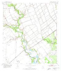
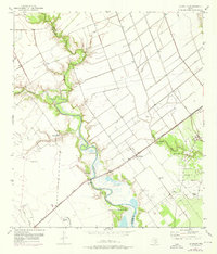
The boundary between Jackson Co and Victoria Co is defined by the winding course of Garcitas Creek, a waterway that dominates this 1952 landscape. The settlement of La Salle serves as a small rail-side hub along the Missouri Pacific line, which cuts a straight diagonal across the drainage basins. The area’s economic character is shaped by both ranching and the petroleum industry, evidenced by the presence of a dedicated Oil Field and numerous Flowing Wells scattered near the creek's meandering banks. Irrigation and land management are visible through an extensive network of Levees and scattered Windmills, highlighting the efforts to control the coastal plains. Smaller tributaries like Arenosa Creek, Venado Creek, and the uniquely named Kentucky Mutt Cr feed into the primary channel, creating a complex wetland environment.
Find a feature on this map
15 named features on this map. Tap any name to fly to it.
Don’t see what you’re looking for? This feature index may not catch every label — zoom into the map to look around manually.
Map Details
Editions of this 1952 La Salle Map
Other maps of this area

1951 · Inez
USGS Topo · 1:24,000

1952 · Manson
USGS Topo · 1:24,000

1952 · Point Comfort
USGS Topo · 1:24,000

1952 · Edna
USGS Topo · 1:24,000

1952 · Kamey
USGS Topo · 1:24,000

1952 · Marcado Creek
USGS Topo · 1:24,000

1952 · Placedo
USGS Topo · 1:24,000

1952 · Lolita
USGS Topo · 1:24,000

1953 · Beeville
USGS Topo · 1:250,000

1956 · Beeville
USGS Topo · 1:250,000