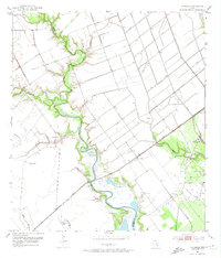
1952 Map of La Salle
USGS Topo · Published 1974About this map
Garcitas Creek meanders sharply through the coastal prairies along the boundary of Victoria and Jackson counties, defining a landscape of active water management and industrial development in the early 1950s. The settlement of La Salle serves as a central point along the Missouri Pacific railroad, which cuts a straight line across the quadrangle. This area reveals an economy transitioning between traditional ranching and petroleum extraction, evidenced by an extensive Oil Field with numerous Oil Wells and Oil Tanks.
Find a feature on this map
13 named features on this map. Tap any name to fly to it.
Don’t see what you’re looking for? This feature index may not catch every label — zoom into the map to look around manually.
Map Details
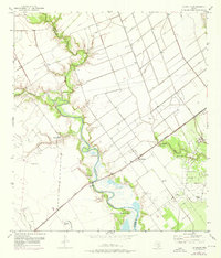
Editions of this 1952 La Salle Map
Other maps of this area

1951 · Inez
USGS Topo · 1:24,000

1952 · Manson
USGS Topo · 1:24,000

1952 · Point Comfort
USGS Topo · 1:24,000

1952 · Edna
USGS Topo · 1:24,000

1952 · Kamey
USGS Topo · 1:24,000

1952 · La Salle
USGS Topo · 1:24,000

1952 · Marcado Creek
USGS Topo · 1:24,000

1952 · Placedo
USGS Topo · 1:24,000

1952 · Lolita
USGS Topo · 1:24,000

1953 · Beeville
USGS Topo · 1:250,000