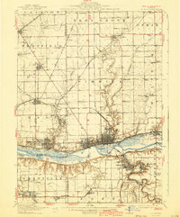
1913 Map of La Salle
USGS Topo · Published 1940About this map
The industrial and transport hub of La Salle and Peru is the centerpiece of this study, where the Illinois River corridor meets a dense network of early 20th-century railroads. The map records a landscape transitioning between heavy industry and rural education, evidenced by the proximity of St Bedes College to numerous country schools like Deener School and Aitkin School. This era was characterized by a massive rail infrastructure, including the Chicago Rock Island and Pacific RR and the New York Central RR, which serviced coal-rich settlements like Ladd and Cherry.
Find a feature on this map
81 named features on this map. Tap any name to fly to it.
Don’t see what you’re looking for? This feature index may not catch every label — zoom into the map to look around manually.
Map Details
Editions of this 1913 La Salle Map
4 editions found
Other maps of this area

1892 · Ottawa
USGS Topo · 1:62,500

1893 · Lacon
USGS Topo · 1:62,500

1893 · Hennepin
USGS Topo · 1:62,500

1893 · Lasalle
USGS Topo · 1:62,500

1909 · Hennepin
USGS Topo · 1:62,500

1911 · La Salle
USGS Topo · 1:62,500

1911 · Hennepin
USGS Topo · 1:62,500

1913 · La Salle
USGS Topo · 1:62,500

1915 · Ottawa
USGS Topo · 1:62,500

1925 · Streator
USGS Topo · 1:62,500