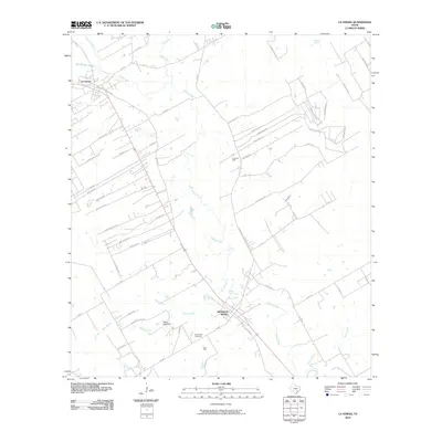
2010 Map of La Vernia
USGS Topo · Published 2010About this map
Cibolo Creek meanders southeastward through this part of Wilson County, serving as the primary geographical spine for the settlements of La Vernia and Sutherland Springs. The landscape is a mix of agricultural utility and petroleum extraction, evidenced by the Linne Oil Field and K Oil Field located east of the main waterway. Local genealogy is anchored by the Sutherland Cemetery, situated near the confluence where Gum Branch approaches the main creek. Several water sources define the area's hydrology beyond the main creek, including Sulphur Spring, Denning Spring, and the Dagen Lake Dam. A dense network of local roads such as FM 775, FM 539, and FM 2772 connects these rural communities, while family-named routes like Enck Ln and Deager Pt suggest the deep-rooted landholdings of the region. The map captures a transition toward modern residential development near the northern settlements while maintaining the traditional oil-and-water resource patterns of South Texas.
Find a feature on this map
66 named features on this map. Tap any name to fly to it.
Don’t see what you’re looking for? This feature index may not catch every label — zoom into the map to look around manually.
Map Details
Editions of this 2010 La Vernia Map
This is the sole edition of this map. No revisions or reprints were ever made.
Other maps of this area

1920 · Smiley
USGS Topo · 1:125,000

1936 · Floresville
USGS Topo · 1:62,500

1942 · Dewville
USGS Topo · 1:62,500

1953 · Seguin
USGS Topo · 1:250,000

1954 · San Antonio
USGS Topo · 1:250,000

1956 · Dewville
USGS Topo · 1:62,500

1957 · San Antonio
USGS Topo · 1:250,000

1957 · New Berlin
USGS Topo · 1:24,000

1958 · Seguin
USGS Topo · 1:250,000

1958 · La Vernia SW
USGS Topo · 1:24,000