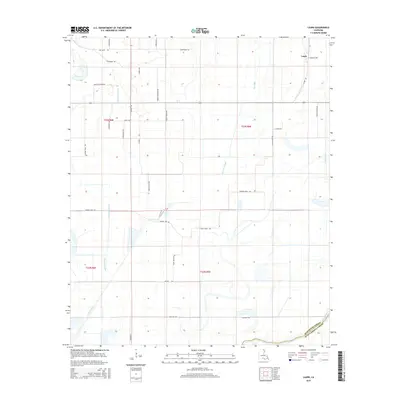
2015 Map of Laark
USGS Topo · Published 2015About this map
Laark stands as the primary settlement in this corner of the Mississippi Delta, positioned near the boundary of Morehouse Parish and West Carroll Parish. The landscape is defined by an intricate network of waterways including Shackleford Bayou, Dry Bayou, and Coffee Bayou, which drain toward the Boeuf River in the southeast. This 2015 survey reveals a terrain heavily influenced by the drainage patterns of the lowland South, where features like Crane Lake and Black Pond Slough break the grid of section lines and local roads. The map's detail provides a clear view of the rural infrastructure, from the winding path of La Ark Rd to family-named landmarks like Armstrong Rd and Hance Coleman Rd, which reflect the localized nature of the area's agricultural and homesteading history.
Find a feature on this map
39 named features on this map. Tap any name to fly to it.
Don’t see what you’re looking for? This feature index may not catch every label — zoom into the map to look around manually.
Map Details
Editions of this 2015 Laark Map
This is the sole edition of this map. No revisions or reprints were ever made.
Other maps of this area

1935 · Wilmot
USGS Topo · 1:62,500

1935 · Oak Grove
USGS Topo · 1:62,500

1935 · Bonita
USGS Topo · 1:62,500

1936 · Eudora
USGS Topo · 1:62,500

1953 · Greenwood
USGS Topo · 1:250,000

1955 · Jackson
USGS Topo · 1:250,000

1956 · Greenwood
USGS Topo · 1:250,000

1957 · Eudora
USGS Topo · 1:62,500

1958 · Oak Grove
USGS Topo · 1:62,500

1958 · Bonita
USGS Topo · 1:62,500