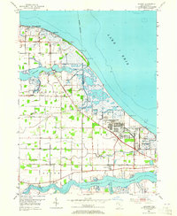
1952 Map of Lacarne
USGS Topo · Published 1965About this map
Camp Perry and the Erie Ordnance Depot dominate the Lake Erie shoreline in this mid-century portrait of Ottawa County's coastal defenses and industrial landscape. The map details a complex network of marshlands and inlets where the Toussaint River and Rushaw Creek meet the lake, punctuated by several observation towers used for monitoring range activities. This area reflects a specialized military and transportation hub, with the New York Central railroad corridor cutting through the southern landscape near Lacarne.
Find a feature on this map
28 named features on this map. Tap any name to fly to it.
Don’t see what you’re looking for? This feature index may not catch every label — zoom into the map to look around manually.
Map Details
Editions of this 1952 Lacarne Map
2 editions found
Other maps of this area

1900 · Oak Harbor
USGS Topo · 1:62,500

1901 · Put-In-Bay
USGS Topo · 1:62,500

1901 · Bellevue
USGS Topo · 1:62,500

1901 · Fremont
USGS Topo · 1:62,500

1903 · Bellevue
USGS Topo · 1:62,500

1903 · Fremont
USGS Topo · 1:62,500

1903 · Put In Bay
USGS Topo · 1:62,500

1952 · Oak Harbor
USGS Topo · 1:24,000

1952 · Lacarne
USGS Topo · 1:24,000

1952 · Oak Harbor
USGS Topo · 1:62,500