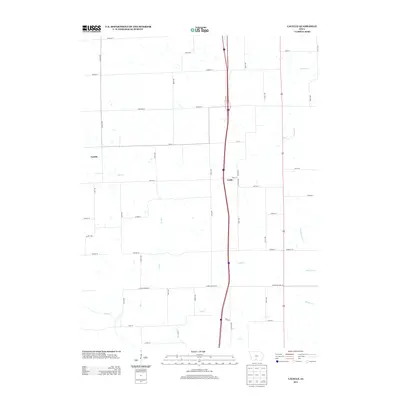
2013 Map of Lacelle
USGS Topo · Published 2013About this map
Lacelle and Leslie anchor this rural landscape in Clarke County, where the southern Iowa prairie is defined by a dense network of watercourses. The map captures a moment in 2013 when the agricultural grid is interrupted by the winding paths of S White Breast Cr, N Hoosier Cr, and Wolf Cr. A significant cultural marker is the Mormon Trl, which traverses the eastern portion of the quadrangle near Benson ST, reflecting the deep migration history that shaped the region. The landscape is primarily divided into large agricultural tracts, with the Clarke-Decatur ST serving as a prominent southern boundary line. This survey provides a clear view of the rural road network, from established routes like Lacelle RD to the local farm-to-market connectors such as 200th Ave.
Find a feature on this map
48 named features on this map. Tap any name to fly to it.
Don’t see what you’re looking for? This feature index may not catch every label — zoom into the map to look around manually.
Map Details
Editions of this 2013 Lacelle Map
This is the sole edition of this map. No revisions or reprints were ever made.
Other maps of this area

1950 · New Virginia
USGS Topo · 1:62,500

1951 · Osceola
USGS Topo · 1:62,500

1952 · New Virginia
USGS Topo · 1:62,500

1954 · Centerville
USGS Topo · 1:250,000

1954 · Des Moines
USGS Topo · 1:250,000

1956 · Des Moines
USGS Topo · 1:250,000

1957 · Des Moines
USGS Topo · 1:250,000

1957 · Centerville
USGS Topo · 1:250,000

1958 · Centerville
USGS Topo · 1:250,000

1965 · Weldon
USGS Topo · 1:24,000