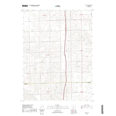
2018 Map of Lacelle
USGS Topo · Published 2018About this map
Leslie serves as a central landmark within this portion of Southern Iowa, situated along the north-south highway corridor that bisects the landscape. This area is characterized by a dense network of watercourses, including Wolf Cr and Chariton Cr, which define the drainage patterns across the rural terrain. The mapping reflects the agricultural grid of Clarke and Decatur counties, where section lines are strictly maintained by roads like Garden St and Doyle St. Genealogy researchers will find value in the placement of Lacelle Cem and Green Bay Cem, which provide specific points of reference for local families. The southern boundary line between Clarke Co and Decatur Co marks a transition in township jurisdictions, while the various branches of Hoosier Cr and S White Breast Cr highlight the region's complex hydrology.
Find a feature on this map
35 named features on this map. Tap any name to fly to it.
Don’t see what you’re looking for? This feature index may not catch every label — zoom into the map to look around manually.
Map Details
Editions of this 2018 Lacelle Map
This is the sole edition of this map. No revisions or reprints were ever made.
Other maps of this area

1950 · New Virginia
USGS Topo · 1:62,500

1951 · Osceola
USGS Topo · 1:62,500

1952 · New Virginia
USGS Topo · 1:62,500

1954 · Centerville
USGS Topo · 1:250,000

1954 · Des Moines
USGS Topo · 1:250,000

1956 · Des Moines
USGS Topo · 1:250,000

1957 · Des Moines
USGS Topo · 1:250,000

1957 · Centerville
USGS Topo · 1:250,000

1958 · Centerville
USGS Topo · 1:250,000

1965 · Weldon
USGS Topo · 1:24,000