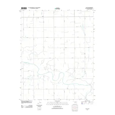
2012 Map of Lacey
USGS Topo · Published 2012About this map
The Cimarron River winds through the southern half of this Oklahoma landscape, carving a wide path across the rural terrain of Kingfisher County. The small community of Lacey sits at the northern edge, serving as a focal point for the surrounding agricultural grid. This 2012 survey illustrates the methodical township-and-range road system, with numbered routes like e0630 RD and n2770 RD partitioning the land into precise sections. For those researching local families, the presence of the Lacey Cem near the town site and the Wilhite Cem to the east provides critical points of reference for genealogical study. The hydrology is defined by the river and its local tributaries, including Preacher Cr, which flows southward through the eastern sections to join the main river valley.
Find a feature on this map
21 named features on this map. Tap any name to fly to it.
Don’t see what you’re looking for? This feature index may not catch every label — zoom into the map to look around manually.
Map Details
Editions of this 2012 Lacey Map
This is the sole edition of this map. No revisions or reprints were ever made.
Other maps of this area

1892 · Kingfisher
USGS Topo · 1:125,000

1893 · Hennessey
USGS Topo · 1:62,500

1893 · Loyal
USGS Topo · 1:62,500

1893 · Ames
USGS Topo · 1:62,500

1895 · Kingfisher
USGS Topo · 1:125,000

1954 · Oklahoma City
USGS Topo · 1:250,000

1955 · Clinton
USGS Topo · 1:250,000

1955 · Enid
USGS Topo · 1:250,000

1955 · Woodward
USGS Topo · 1:250,000

1956 · Ames
USGS Topo · 1:62,500