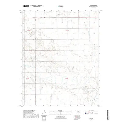
2018 Map of Lacey
USGS Topo · Published 2018About this map
The Cimarron River meanders across this rural section of Kingfisher County, defining the local geography as it flows through the southern half of the quadrangle. In the northern reaches, the small community of Lacey sits along W Jack Choate Ave, serving as a central point in an area dominated by an orderly grid of county roads such as N2770 Rd and E0660 Rd. This modern survey illustrates the persistent agricultural and section-line landscape characteristic of the region. Local history is anchored by the Lacey Cem near the townsite and the Wilhite Cem located further east near the banks of Preacher Cr. The map's detailed terrain data shows the complex drainage patterns and low-lying areas surrounding the river's path, highlighting the environmental factors that have shaped local settlement and road placement since the land run era.
Find a feature on this map
25 named features on this map. Tap any name to fly to it.
Don’t see what you’re looking for? This feature index may not catch every label — zoom into the map to look around manually.
Map Details
Editions of this 2018 Lacey Map
This is the sole edition of this map. No revisions or reprints were ever made.
Other maps of this area

1892 · Kingfisher
USGS Topo · 1:125,000

1893 · Hennessey
USGS Topo · 1:62,500

1893 · Loyal
USGS Topo · 1:62,500

1893 · Ames
USGS Topo · 1:62,500

1895 · Kingfisher
USGS Topo · 1:125,000

1954 · Oklahoma City
USGS Topo · 1:250,000

1955 · Clinton
USGS Topo · 1:250,000

1955 · Enid
USGS Topo · 1:250,000

1955 · Woodward
USGS Topo · 1:250,000

1956 · Ames
USGS Topo · 1:62,500