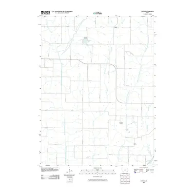
2010 Map of Ladoga
USGS Topo · Published 2010About this map
Ladoga sits in a rural landscape defined by the complex drainage system of the One Hundred and Two River. This 2010 survey illustrates the convergence of multiple forks, including the West Branch and the West Fork, which meander through a grid of section-line roads like Diamond Ave and 240th St. The terrain is punctuated by small-scale water management, notably at Windmill Lake and the Windmill Lake Dam. For local historians and genealogists, the map provides precise locations for the Graceland Cemetery and the Ferrell-Ross Cemetery, offering a reliable record of these community landmarks within the agricultural patchwork of Taylor County.
Find a feature on this map
37 named features on this map. Tap any name to fly to it.
Don’t see what you’re looking for? This feature index may not catch every label — zoom into the map to look around manually.
Map Details
Editions of this 2010 Ladoga Map
This is the sole edition of this map. No revisions or reprints were ever made.
Other maps of this area

1940 · Bedford
USGS Topo · 1:62,500

1940 · New Market
USGS Topo · 1:62,500

1943 · Bedford
USGS Topo · 1:62,500

1943 · New Market
USGS Topo · 1:62,500

1955 · Nebraska City
USGS Topo · 1:250,000

1957 · Nebraska City
USGS Topo · 1:250,000

1958 · Nebraska City
USGS Topo · 1:250,000

1980 · Gravity
USGS Topo · 1:24,000
1980 · Hopkins SW
USGS Topo · 1:24,000

1980 · Guss
USGS Topo · 1:24,000