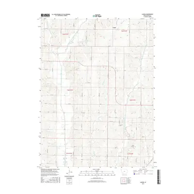
2015 Map of Ladoga
USGS Topo · Published 2015About this map
Ladoga sits in the northern reaches of this Taylor County landscape, defined by the winding tributaries of the One Hundred and Two River system. The drainage patterns of the Middle Fork One Hundred and Two River and the West Fork One Hundred and Two River create a rhythmic north-south grain across the terrain, shaping the placement of rural roads and farmsteads. Cultural markers of the area's long-term settlement are visible at Graceland Cem and Ferrell-Ross Cem, which serve as significant sites for local genealogical research. Small water bodies like Windmill Lake and seasonal drainages such as Brushy Cr and Dougherty Cr punctuate the agricultural sections, illustrating the water-dependent nature of the region's land use and township organization during this mid-2010s era.
Find a feature on this map
47 named features on this map. Tap any name to fly to it.
Don’t see what you’re looking for? This feature index may not catch every label — zoom into the map to look around manually.
Map Details
Editions of this 2015 Ladoga Map
This is the sole edition of this map. No revisions or reprints were ever made.
Other maps of this area

1940 · Bedford
USGS Topo · 1:62,500

1940 · New Market
USGS Topo · 1:62,500

1943 · Bedford
USGS Topo · 1:62,500

1943 · New Market
USGS Topo · 1:62,500

1955 · Nebraska City
USGS Topo · 1:250,000

1957 · Nebraska City
USGS Topo · 1:250,000

1958 · Nebraska City
USGS Topo · 1:250,000

1980 · Gravity
USGS Topo · 1:24,000
1980 · Hopkins SW
USGS Topo · 1:24,000

1980 · Guss
USGS Topo · 1:24,000