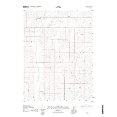
2018 Map of Ladoga
USGS Topo · Published 2018About this map
Ladoga sits in the northern reaches of Taylor County, centered within a landscape defined by the distinct branches of the One Hundred and Two River system. The drainage patterns of the West Fork One Hundred and Two River and the Middle Fork One Hundred and Two River carve through the terrain, dictating the placement of the section-line road network that characterizes this rural Iowa township. To the north, Windmill Lake provides a localized water feature near the intersection of 220th St and Franklin Ave. For those tracing local heritage, the map identifies specific burial grounds including Graceland Cem and the Ferrell-Ross Cem, which anchor the history of early families to the land near the confluence of these prairie streams.
Find a feature on this map
42 named features on this map. Tap any name to fly to it.
Don’t see what you’re looking for? This feature index may not catch every label — zoom into the map to look around manually.
Map Details
Editions of this 2018 Ladoga Map
This is the sole edition of this map. No revisions or reprints were ever made.
Other maps of this area

1940 · Bedford
USGS Topo · 1:62,500

1940 · New Market
USGS Topo · 1:62,500

1943 · Bedford
USGS Topo · 1:62,500

1943 · New Market
USGS Topo · 1:62,500

1955 · Nebraska City
USGS Topo · 1:250,000

1957 · Nebraska City
USGS Topo · 1:250,000

1958 · Nebraska City
USGS Topo · 1:250,000

1980 · Gravity
USGS Topo · 1:24,000
1980 · Hopkins SW
USGS Topo · 1:24,000

1980 · Guss
USGS Topo · 1:24,000