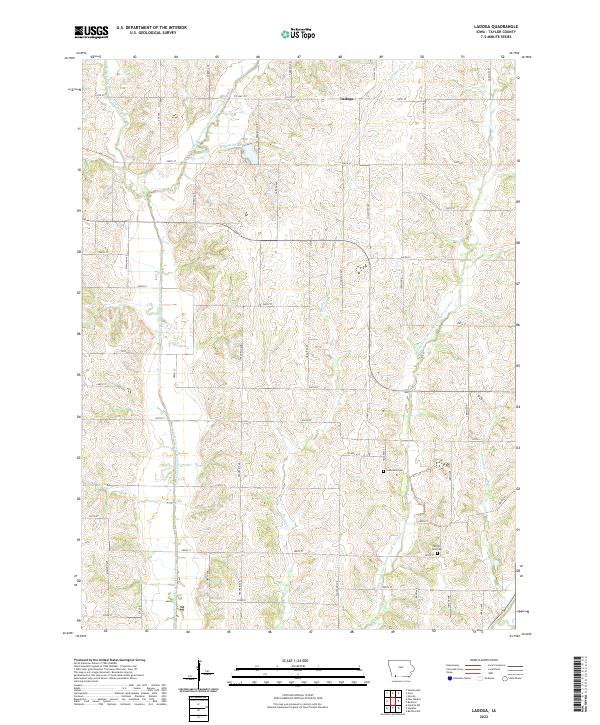
2022 Map of Ladoga
USGS Topo · Published 2022About this map
Ladoga sits at the northern edge of this Taylor County landscape, where the headwaters of the One Hundred and Two River system carve a complex drainage pattern through the agricultural heartland. The map documents the intricate network of the West Fork One Hundred and Two River and its various tributaries, including the West Branch One Hundred and Two River and Middle Fork One Hundred and Two River. These waterways are punctuated by local features like Windmill Lake and Brushy Cr. For those researching family history in southern Iowa, the sheet preserves the locations of local landmarks such as Graceland Cem and Ferrell-Ross Cem. The landscape is defined by a rigid grid of section roads like Garden Ave and Hillcrest Ave, reflecting the enduring Public Land Survey System structure that has shaped this region for generations.
Find a feature on this map
47 named features on this map. Tap any name to fly to it.
Don’t see what you’re looking for? This feature index may not catch every label — zoom into the map to look around manually.
Map Details
Editions of this 2022 Ladoga Map
This is the sole edition of this map. No revisions or reprints were ever made.
Other maps of this area

1940 · Bedford
USGS Topo · 1:62,500

1940 · New Market
USGS Topo · 1:62,500

1943 · Bedford
USGS Topo · 1:62,500

1943 · New Market
USGS Topo · 1:62,500

1955 · Nebraska City
USGS Topo · 1:250,000

1957 · Nebraska City
USGS Topo · 1:250,000

1958 · Nebraska City
USGS Topo · 1:250,000

1980 · Gravity
USGS Topo · 1:24,000
1980 · Hopkins SW
USGS Topo · 1:24,000

1980 · Guss
USGS Topo · 1:24,000