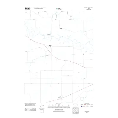
2013 Map of Ladora
USGS Topo · Published 2013About this map
The Iowa River meanders across the northern portion of this Iowa County landscape, creating a complex network of wetlands and oxbows just north of Koszta. This 2013 survey illustrates a predominantly agricultural region where small settlements like Dayton and Ladora serve as local anchors. The presence of the Koszta Access Public Hunting Area along the riverbanks highlights the preservation of riverine habitats amidst the surrounding farm grid.
Find a feature on this map
56 named features on this map. Tap any name to fly to it.
Don’t see what you’re looking for? This feature index may not catch every label — zoom into the map to look around manually.
Map Details
Editions of this 2013 Ladora Map
This is the sole edition of this map. No revisions or reprints were ever made.
Other maps of this area

1954 · Des Moines
USGS Topo · 1:250,000

1956 · Des Moines
USGS Topo · 1:250,000

1957 · Des Moines
USGS Topo · 1:250,000

1965 · Ladora
USGS Topo · 1:24,000

1965 · Keystone South
USGS Topo · 1:24,000
1965 · Marengo
USGS Topo · 1:24,000
1965 · Blairstown
USGS Topo · 1:24,000
1968 · Williamsburg
USGS Topo · 1:24,000

1968 · Victor
USGS Topo · 1:24,000

1968 · Belle Plaine
USGS Topo · 1:24,000