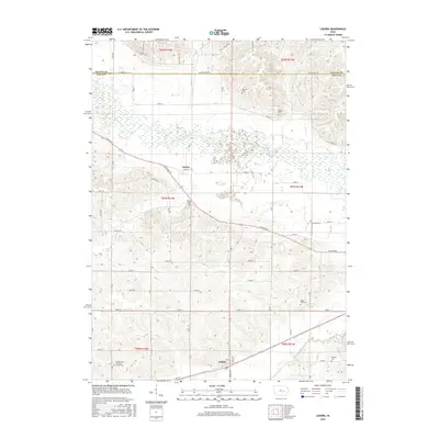
2015 Map of Ladora
USGS Topo · Published 2015About this map
The Iowa River meanders across the northern half of this Iowa County landscape, creating a wide floodplain of wetlands and tributaries like Buckeye Cr and Willow Brook. In the southern reaches, the settlement of Ladora sits along a major corridor between Big Bear Creek and Little Bear Cr, serving as a focal point for the surrounding agricultural section lines. This 2015 survey reveals a terrain defined by its watercourses and a high density of rural burial grounds, which offer significant value for genealogical research in the region.
Find a feature on this map
43 named features on this map. Tap any name to fly to it.
Don’t see what you’re looking for? This feature index may not catch every label — zoom into the map to look around manually.
Map Details
Editions of this 2015 Ladora Map
This is the sole edition of this map. No revisions or reprints were ever made.
Other maps of this area

1954 · Des Moines
USGS Topo · 1:250,000

1956 · Des Moines
USGS Topo · 1:250,000

1957 · Des Moines
USGS Topo · 1:250,000

1965 · Ladora
USGS Topo · 1:24,000

1965 · Keystone South
USGS Topo · 1:24,000
1965 · Marengo
USGS Topo · 1:24,000
1965 · Blairstown
USGS Topo · 1:24,000
1968 · Williamsburg
USGS Topo · 1:24,000

1968 · Victor
USGS Topo · 1:24,000

1968 · Belle Plaine
USGS Topo · 1:24,000