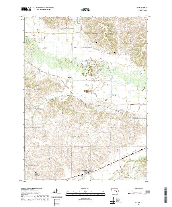
2022 Map of Ladora
USGS Topo · Published 2022About this map
The Iowa River meanders across this landscape, defining the rural character between the small communities of Ladora and Koszta. In the south, the settlement of Ladora sits along a transport corridor where Big Bear Creek flows, while the northern reaches transition into the rolling terrain surrounding Buckeye Cr and Willow Brook. This area is characterized by its numerous historic burial sites, providing a significant record for local genealogy. From the Dayton Cem and Athey Cem in the north to the Maple Tree Cem and Kitchen Cem further south, these locations mark the family histories of the region. The Seventh Day Adventist Church Cem near Ladora and the Koszta Cem further illustrate the distribution of early community centers. The map also traces the drainage patterns of Honey Cr and Little Bear Cr, showing how these waterways influenced the placement of the local road network and section lines.
Find a feature on this map
62 named features on this map. Tap any name to fly to it.
Don’t see what you’re looking for? This feature index may not catch every label — zoom into the map to look around manually.
Map Details
Editions of this 2022 Ladora Map
This is the sole edition of this map. No revisions or reprints were ever made.
Other maps of this area

1954 · Des Moines
USGS Topo · 1:250,000

1956 · Des Moines
USGS Topo · 1:250,000

1957 · Des Moines
USGS Topo · 1:250,000

1965 · Ladora
USGS Topo · 1:24,000

1965 · Keystone South
USGS Topo · 1:24,000
1965 · Marengo
USGS Topo · 1:24,000
1965 · Blairstown
USGS Topo · 1:24,000
1968 · Williamsburg
USGS Topo · 1:24,000

1968 · Victor
USGS Topo · 1:24,000

1968 · Belle Plaine
USGS Topo · 1:24,000