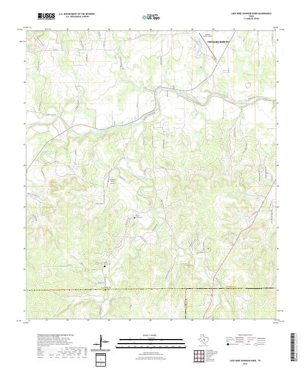
2022 Map of Lady Bird Johnson Park
USGS Topo · Published 2022About this map
The Pedernales River meanders across this Hill Country landscape, defining a terrain of draws and creeks south of Fredericksburg. The map reveals a transition from the structured outskirts of town, anchored by the Gillespie County Airport, into a rural expanse of family-named ranch roads and small aviation strips like the Cameron Ranch Airport. This area is characterized by its tributary networks, where Bear Creek and Muesebach Cr carve through the limestone-rich topography toward the river.
Find a feature on this map
73 named features on this map. Tap any name to fly to it.
Don’t see what you’re looking for? This feature index may not catch every label — zoom into the map to look around manually.
Map Details
Editions of this 2022 Lady Bird Johnson Park Map
This is the sole edition of this map. No revisions or reprints were ever made.
Other maps of this area

1894 · Fredericksburg
USGS Topo · 1:125,000

1894 · Kerrville
USGS Topo · 1:125,000

1954 · Llano
USGS Topo · 1:250,000

1955 · Llano
USGS Topo · 1:250,000

1956 · Llano
USGS Topo · 1:250,000

1963 · Cain City
USGS Topo · 1:24,000

1964 · Oak Crest Park
USGS Topo · 1:24,000

1964 · Morris Ranch
USGS Topo · 1:24,000
1964 · Rafter Hollow
USGS Topo · 1:24,000
1964 · Cypress Creek
USGS Topo · 1:24,000