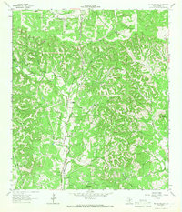
1964 Map of Rafter Hollow
USGS Topo · Published 1966About this map
The Old San Antonio Road cuts through the heart of this landscape, tracing a historic transit corridor through the Texas Hill Country. During this mid-century period, the area remained defined by significant family holdings and working livestock operations, including the Hillingdon Ranch, Rausch Ranch, and Jung Ranch. The topography is characterized by deep drainages like Rafter Hollow and prominent elevations such as Big Hill, Dunners Mountain, and Schleicher Mountain.
Find a feature on this map
24 named features on this map. Tap any name to fly to it.
Don’t see what you’re looking for? This feature index may not catch every label — zoom into the map to look around manually.
Map Details
Editions of this 1964 Rafter Hollow Map
2 editions found
Other maps of this area

1894 · Fredericksburg
USGS Topo · 1:125,000

1954 · Llano
USGS Topo · 1:250,000

1954 · San Antonio
USGS Topo · 1:250,000

1955 · Llano
USGS Topo · 1:250,000

1956 · Comfort
USGS Topo · 1:62,500

1956 · Llano
USGS Topo · 1:250,000

1957 · Boerne
USGS Topo · 1:62,500

1957 · San Antonio
USGS Topo · 1:250,000

1961 · Stonewall
USGS Topo · 1:24,000

1963 · Whitworth Ranch
USGS Topo · 1:24,000