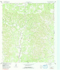
1964 Map of Rafter Hollow
USGS Topo · Published 1992About this map
The Old San Antonio Road follows a north-south path through this pocket of the Texas Hill Country, cutting through a landscape defined by significant elevations like Big Hill and Schleicher Mountain. The terrain is deeply carved by a network of seasonal drainages and springs, including Polecat Creek, Darmstadt Creek, and West Fork Hunters Creek. Large family holdings are a defining feature of the mid-1960s landscape, with established sites such as Jung Ranch, Hilltop Ranch, and Rausch Ranch marking the valley floors and higher plateaus. Local landmarks like Dunners Mountain and Rafter Hollow provide topographic context for this rural area, which remained largely undeveloped outside of ranching and early transportation corridors during this period. The survey also notes several Gravel Pit locations, indicating the small-scale mineral extraction supporting local road improvements.
Find a feature on this map
23 named features on this map. Tap any name to fly to it.
Don’t see what you’re looking for? This feature index may not catch every label — zoom into the map to look around manually.
Map Details
Editions of this 1964 Rafter Hollow Map
2 editions found

Other maps of this area

1894 · Fredericksburg
USGS Topo · 1:125,000

1954 · Llano
USGS Topo · 1:250,000

1954 · San Antonio
USGS Topo · 1:250,000

1955 · Llano
USGS Topo · 1:250,000

1956 · Comfort
USGS Topo · 1:62,500

1956 · Llano
USGS Topo · 1:250,000

1957 · Boerne
USGS Topo · 1:62,500

1957 · San Antonio
USGS Topo · 1:250,000

1961 · Stonewall
USGS Topo · 1:24,000

1963 · Whitworth Ranch
USGS Topo · 1:24,000