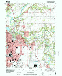
1998 Map of Lafayette East
USGS Topo · Published 2001About this map
Lafayette and its eastern sprawl dominate this 1998 survey, where the urban grid of the Fairfield township meets the meandering drainage of Wildcat Creek. The landscape transition is marked by a concentration of community institutions and transportation hubs, from the Aretz Airport in the north to the Halsmer Airport near the southern boundary. Residential expansion is evident in developments like Eastwitch and Meadowbrook, while older rural markers such as North Union Cem and Swisher-Hurtz Cem remain preserved in the outlying townships of Washington and Perry. The Wabash River carves through the northwest corner, shadowed by the historic Tippecanoe Conservation Club. These topographical details provide a clear view of how the city's infrastructure and highway interchanges integrated with the established agricultural tracts and natural waterways at the close of the century.
Find a feature on this map
48 named features on this map. Tap any name to fly to it.
Don’t see what you’re looking for? This feature index may not catch every label — zoom into the map to look around manually.
Map Details
Editions of this 1998 Lafayette East Map
This is the sole edition of this map. No revisions or reprints were ever made.
Other maps of this area

1941 · Lafayette
USGS Topo · 1:24,000

1942 · Lafayette
USGS Topo · 1:24,000

1950 · Lafayette
USGS Topo · 1:24,000

1953 · Danville
USGS Topo · 1:250,000

1955 · Danville
USGS Topo · 1:250,000

1956 · Danville
USGS Topo · 1:250,000

1961 · Mulberry
USGS Topo · 1:24,000

1961 · Pyrmont
USGS Topo · 1:24,000

1961 · Romney
USGS Topo · 1:24,000

1961 · Stockwell
USGS Topo · 1:24,000