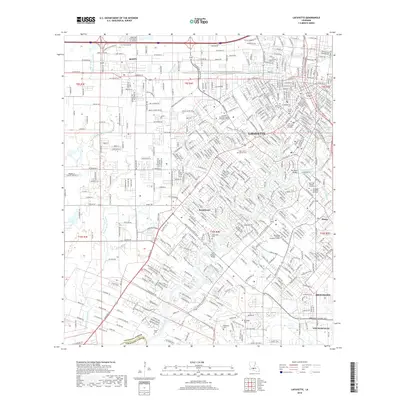
2018 Map of Lafayette
USGS Topo · Published 2018About this map
The Vermilion River snakes through this 2018 survey of South Louisiana, defining the landscape between the expanding urban reach of Lafayette and the surrounding communities of Scott and Broussard. The map captures a detailed view of the region's educational and spiritual centers, featuring the University of Louisiana at Lafayette and the landmark Saint John Cathedral. Several burial grounds are documented, providing a valuable resource for genealogists, including the Jewish Cemetery, Whittington Cemetery, and the Saint John Fatima Cemetery.
Find a feature on this map
40 named features on this map. Tap any name to fly to it.
Don’t see what you’re looking for? This feature index may not catch every label — zoom into the map to look around manually.
Map Details
Editions of this 2018 Lafayette Map
This is the sole edition of this map. No revisions or reprints were ever made.
Other maps of this area

1934 · Duson
USGS Topo · 1:31,680

1939 · St. Martinsville
USGS Topo · 1:62,500

1940 · Arnaudville
USGS Topo · 1:62,500

1946 · Milton
USGS Topo · 1:31,680

1946 · Leroy
USGS Topo · 1:31,680

1946 · Lafayette
USGS Topo · 1:31,680

1952 · Lake Charles
USGS Topo · 1:250,000

1954 · Lafayette
USGS Topo · 1:31,680

1954 · Duson
USGS Topo · 1:31,680
1954 · Leroy
USGS Topo · 1:31,680