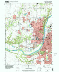
1998 Map of Lafayette West
USGS Topo · Published 2001About this map
Purdue University anchors the landscape of this late-20th-century survey, surrounded by its extensive research network including the Purdue University Agronomy Farm, Horticulture Farm, and Dairy Farm. The sprawling campus and the Purdue University Airport dominate the west bank of the Wabash River, which serves as the primary geographic divide between West Lafayette and the city of Lafayette. The river corridor features significant civic and social landmarks, from the Indiana Veterans Home in the north to the Lafayette Country Club further south.
Find a feature on this map
67 named features on this map. Tap any name to fly to it.
Don’t see what you’re looking for? This feature index may not catch every label — zoom into the map to look around manually.
Map Details
Editions of this 1998 Lafayette West Map
This is the sole edition of this map. No revisions or reprints were ever made.
Other maps of this area

1941 · Lafayette
USGS Topo · 1:24,000

1942 · Otterbein
USGS Topo · 1:24,000

1942 · Lafayette
USGS Topo · 1:24,000

1950 · Lafayette
USGS Topo · 1:24,000

1951 · Otterbein
USGS Topo · 1:24,000

1953 · Danville
USGS Topo · 1:250,000

1955 · Danville
USGS Topo · 1:250,000

1956 · Danville
USGS Topo · 1:250,000

1961 · Romney
USGS Topo · 1:24,000

1961 · Stockwell
USGS Topo · 1:24,000